

Navigating Maine's extensive all-terrain vehicle trail network requires more than just an adventurous spirit. The maine its atv trail map system represents one of the most comprehensive off-road networks in the Northeast, connecting thousands of miles of designated trails across the state's diverse landscapes. Whether you're planning a weekend adventure in the Kennebec Valley or a multi-day expedition through the North Woods, understanding how to access, read, and utilize these trail maps is essential for a safe and enjoyable riding experience. To view our official visitors guide click here.
Understanding Maine's ITS Trail System
The Interconnected Trail System (ITS) forms the backbone of Maine's ATV trail network. This coordinated system links local club trails into a statewide network, allowing riders to travel from region to region on marked, maintained routes.
What Makes the ITS System Unique
Maine's approach to ATV trail management differs significantly from other states. Rather than relying solely on state-managed lands, the maine its atv trail map network depends heavily on collaborative agreements between landowners, ATV clubs, and state agencies.
Key characteristics of the ITS include:
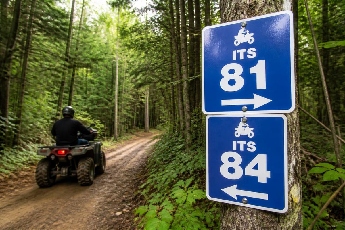
- Numbered trail designations (ITS 81, ITS 84, etc.) for easy navigation
- Standardized signage and trail marking across different regions
- Seasonal maintenance schedules coordinated by local clubs
- Connection points between major riding regions
The system spans approximately 3,500 miles of maintained trails, though the exact mileage fluctuates based on seasonal conditions, landowner agreements, and ongoing trail development projects.
Trail Classification and Access Requirements
Not all trails within the maine its atv trail map system offer the same riding conditions or access requirements. Understanding these distinctions helps riders plan appropriate routes for their skill level and vehicle specifications.
| Trail Type | Description | Typical Width | Difficulty |
|---|---|---|---|
| Primary ITS Routes | Main connectors between regions | 8-12 feet | Moderate |
| Secondary Trails | Regional connections and loops | 6-8 feet | Moderate to Difficult |
| Club Trails | Local networks managed by specific clubs | 4-8 feet | Varies widely |
| Connector Trails | Short links between systems | 4-6 feet | Easy to Moderate |
Registration requirements remain consistent across the system. All ATVs operating on the ITS must display current Maine ATV registration, and riders must carry proof of registration while on trails.
Accessing Digital Trail Maps and Resources
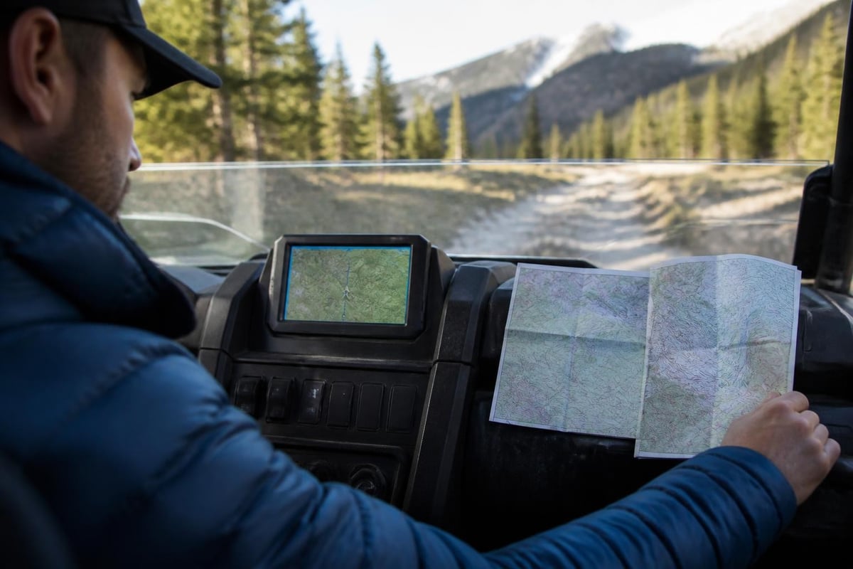
Digital mapping resources have revolutionized how riders plan and navigate Maine's trail systems. Multiple platforms now offer interactive features that traditional paper maps cannot provide.
The ATV Maine interactive maps serve as the primary digital resource for riders planning trips across the state. This platform provides regularly updated trail status information, club contact details, and GPS-compatible route files that sync with popular navigation devices.
Digital Mapping Platform Comparison
Features to look for in digital trail maps:
- Real-time trail condition updates
- GPS coordinate integration
- Downloadable offline map sections
- Trail closure notifications
- Parking area locations with coordinates
The Maine Trail Finder database complements ATV-specific resources by showing how ITS trails intersect with other recreational trail systems. This cross-referencing proves valuable when planning multi-activity trips or identifying trailhead facilities.
For riders venturing into the North Maine Woods region, specialized mapping tools become necessary. The NMWMap platform provides detailed coverage of private logging roads and remote trail sections where standard maine its atv trail map resources may lack detail.
Regional Trail Networks in the Kennebec Valley
The Kennebec Valley region offers distinctive riding opportunities within the broader ITS network. Several numbered routes pass through this area, providing access to varied terrain and connecting to neighboring trail systems.
Major ITS Routes Through Central Maine
ITS 81 represents one of the primary north-south corridors through the Kennebec Valley. This route connects riders from southern Maine communities through central regions and eventually to northern wilderness areas.
ITS 81 highlights:
- Southern terminus near Gray
- Passage through Belgrade Lakes region
- Connection to ITS 84 near Skowhegan
- Northern extension toward Jackman
ITS 84 runs east-west across the region, creating crucial connection points for riders traversing the state horizontally. This route intersects with multiple north-south corridors, making it a strategic planning point for extended trips.
Trail conditions in the Kennebec Valley vary significantly by season and recent weather patterns. Spring mud season (typically late March through early May) may result in temporary trail closures on sections crossing wetlands or low-lying terrain.
Local Club Trail Systems
Individual ATV clubs manage extensive trail networks that feed into the ITS system. These club trails often provide access to scenic viewpoints, historic sites, and local amenities that main ITS routes might bypass.
When reviewing a maine its atv trail map for the Kennebec Valley region, pay attention to club-managed sections. These trails require club membership or day-use passes in addition to state registration. Supporting local clubs through membership directly funds trail maintenance and expansion projects.
Planning Multi-Day Trail Adventures
Extended ATV trips across Maine's ITS network require careful planning beyond basic map reading. Successful multi-day adventures depend on coordinating trail routes with lodging, fuel stops, and potential weather contingencies.
Route Planning Essentials
Calculating realistic daily mileage helps prevent overambitious itineraries. Most recreational riders comfortably cover 60-100 miles per day on mixed terrain, though experienced riders on primary ITS routes may average higher mileage.
Daily planning checklist:
- Morning weather check and trail condition updates
- Fuel range calculation based on terrain
- Identification of alternate routes if closures occur
- Backup communication plan for remote sections
- Emergency contact information for each trail segment
Recent reporting on navigating the North Maine Woods emphasizes the importance of understanding landowner rules and access protocols, particularly when ITS routes cross private forestland. These considerations become critical when planning routes through the western mountains or far northern regions.
Printed Map Resources and Atlases
While digital tools offer convenience, printed maps remain valuable backup resources and planning aids. The comprehensive coverage found in commercial atlases provides context that screen-based maps sometimes lack.
The 2025 Maine ATV Trail Map Atlas offers detailed statewide coverage in a format designed specifically for ATV navigation. This atlas includes topographic context, facilities locations, and notes about challenging trail sections.
Advantages of Printed Maps
Printed resources serve multiple purposes beyond basic navigation. They function as trip planning tools during the pre-season, allowing riders to visualize entire route options simultaneously without screen limitations.
| Printed Map Benefits | Digital Map Benefits |
|---|---|
| No battery or signal required | Real-time condition updates |
| Broad geographic overview | Precise GPS positioning |
| Weather and damage resistant | Interactive route planning |
| Easy group trip planning | Shareable with riding partners |
| Works as backup navigation | Integrates with navigation apps |
Many experienced riders carry both printed maine its atv trail map resources and digital devices, using each tool for its strengths. The printed atlas handles broad route planning and serves as emergency backup, while the digital platform provides turn-by-turn guidance and current conditions.

Safety Considerations and Trail Etiquette
Responsible trail use extends beyond following marked routes. Understanding and practicing proper trail etiquette ensures continued landowner cooperation and sustainable trail access for future generations.
Essential Safety Protocols
Weather conditions in Maine change rapidly, particularly in mountainous regions and during transitional seasons. Riders should monitor forecasts for all areas along planned routes, not just starting points.
Safety equipment requirements:
- Helmet (required by law for riders under 18, recommended for all)
- First aid kit with trail-specific supplies
- Emergency communication device (cell phone plus backup)
- Trail-appropriate clothing for weather extremes
- Tool kit for basic mechanical repairs
Trail etiquette on the maine its atv trail map system includes yielding protocols, speed management in sensitive areas, and respect for posted restrictions. Riders traveling uphill have right-of-way on narrow sections, while faster riders should pass only when safe and visible.
Seasonal Trail Access and Conditions
Maine's ATV trail season typically runs from late May through November, though specific dates vary by region and annual conditions. Some northern sections open earlier, while coastal and southern regions may maintain longer seasons.
Understanding Seasonal Changes
Spring conditions present unique challenges even after official trail openings. Frost heaves, washouts, and lingering soft spots require cautious navigation and potentially route modifications.
Seasonal condition indicators:
- Early season (May-June): Watch for muddy sections and standing water
- Peak season (July-September): Best overall conditions, highest traffic
- Late season (October-November): Leaf cover obscures trail edges, earlier darkness
- Post-season: Trails closed for winter snowmobile use
Fall foliage season creates spectacular riding conditions but also increases trail traffic significantly. Popular routes in the Kennebec Valley and throughout central Maine experience peak usage during the first two weeks of October.
Connecting with Local ATV Communities
Local ATV clubs provide invaluable resources beyond trail maintenance. These organizations offer firsthand knowledge about current conditions, upcoming trail work projects, and region-specific riding tips.
Club membership benefits extend to reciprocal access agreements, organized group rides, and participation in trail development decisions. Many clubs maintain social media groups where members share real-time trail updates and coordinate riding meetups.
When visiting Kennebec Valley Tourism Council for trip planning resources, riders can access information about local clubs, trail conditions, and regional events that coincide with ATV season. The council's comprehensive guides help visitors coordinate ATV adventures with other regional attractions and activities.
Navigating Trailhead Facilities and Amenities
Strategic trailhead facilities make extended rides more manageable and enjoyable. The maine its atv trail map system includes numerous access points with varying amenity levels.
Trailhead Facility Types
Premium trailheads offer parking for multiple vehicles with trailers, restroom facilities, and sometimes even basic maintenance areas. These typically locate near major ITS intersections or popular riding regions.
Basic access points provide parking only, requiring riders to plan fuel and facility stops along routes. Understanding which trailheads offer specific amenities helps in planning daily routes and determining appropriate starting points for different trip types.
Common trailhead amenities:
- Trailer parking (capacity varies by location)
- Restroom facilities (seasonal operation)
- Trail information kiosks with local maps
- Emergency contact information
- Nearby fuel and supply access
Gas stations and services cluster along certain sections of the ITS network, particularly near towns and major intersections. Riders should identify these locations during route planning and carry sufficient fuel for stretches between services.
Integration with Regional Tourism
ATV adventures complement other outdoor activities throughout Maine's regions. The Kennebec Valley specifically offers opportunities to combine trail riding with whitewater rafting, hiking, and cultural experiences in historic towns along the route.
Multi-activity trip planning requires coordinating trail access with lodging that accommodates both ATVs and traditional tourism activities. Many regional accommodations now cater specifically to ATV riders, offering secure parking, washing facilities, and direct trail access.
Understanding how the maine its atv trail map network connects to broader regional attractions enhances trip value and appeal. Routes passing through or near state parks, historic sites, and scenic viewpoints allow riders to experience Maine's diverse offerings beyond the trails themselves.
Successful ATV adventures in Maine depend on thorough preparation using reliable trail maps and current condition information. The ITS network provides thousands of miles of riding opportunities across diverse terrain, from the Kennebec Valley's varied landscapes to the remote wilderness of the North Woods. Whether you're planning a day trip or an extended expedition, Kennebec Valley Tourism Council offers comprehensive resources to help you coordinate your ATV adventure with lodging, dining, and other regional activities, ensuring a memorable experience in this exceptional riding destination.