
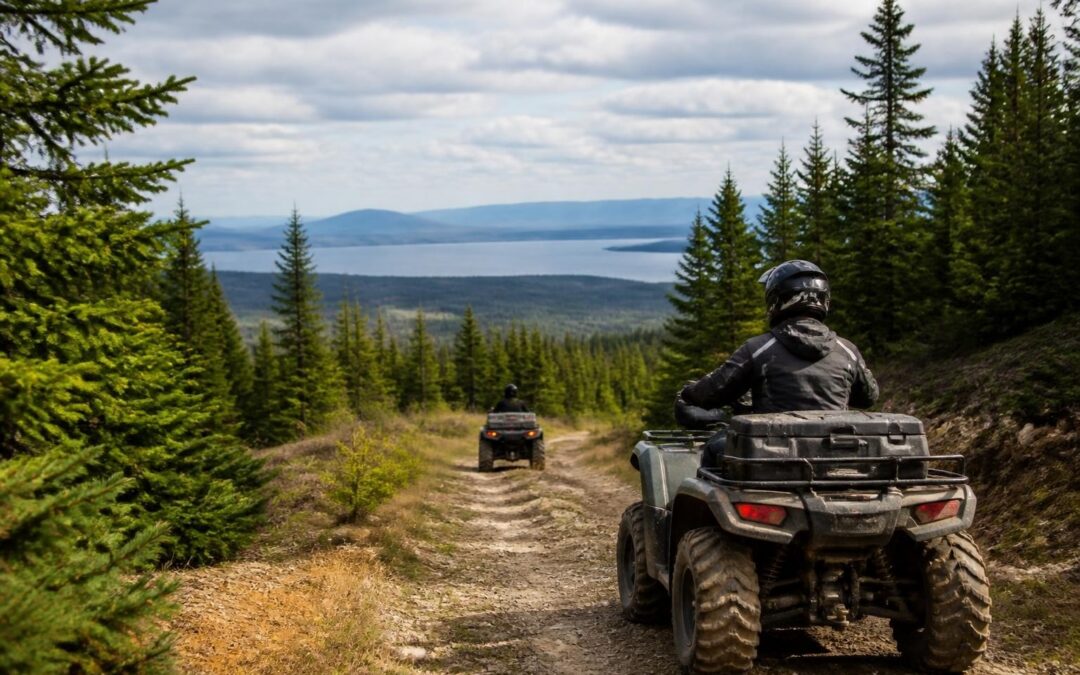
Nestled in the northwestern corner of Maine, Jackman offers some of the most spectacular off-road riding experiences in New England. With over 300 miles of interconnected trails winding through pristine wilderness, this remote community has become a premier destination for ATV enthusiasts. Understanding how to navigate these extensive routes begins with obtaining a reliable jackman maine atv trail map, which serves as your essential companion for exploring the region's diverse terrain, connecting with neighboring trail systems, and ensuring you make the most of your backcountry adventure. To view our official visitors guide click here.
Understanding the Jackman ATV Trail System
The Jackman trail network represents one of Maine's most comprehensive off-road riding areas, connecting directly with the broader Moosehead Region trail system and extending north to the Canadian border. The trails here aren't just local loops-they're part of a vast interconnected system maintained by dedicated clubs and volunteers.
Trail Network Overview
Jackman's ATV trail infrastructure connects several major hubs:
- Downtown Jackman: Central access point with fuel, supplies, and lodging
- Moose River Valley: Scenic riverside routes with wildlife viewing opportunities
- Border region: Trails extending to Quebec for international riding adventures
- Moosehead Lake connections: Links to southern trail networks and additional recreational areas
The official Jackman visitor page provides ATVing guidance that covers seasonal considerations, safety protocols, and local regulations specific to this northern Maine region.
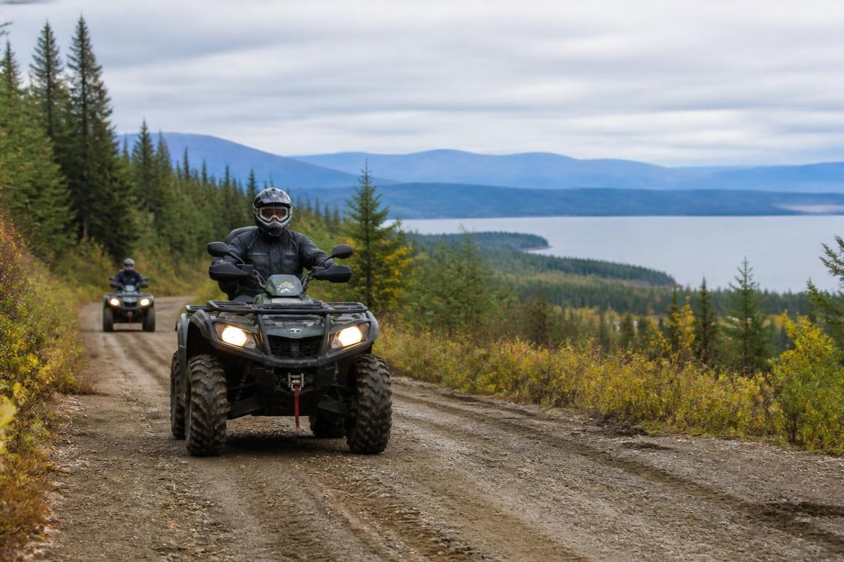
Most trails accommodate ATVs up to 60 inches wide, though riders should verify specific width restrictions on individual routes. The terrain varies from smooth woodland paths to challenging rocky sections, offering experiences suitable for multiple skill levels.
Where to Find Your Jackman Maine ATV Trail Map
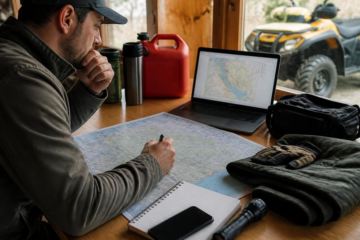
Obtaining an accurate, current jackman maine atv trail map is critical for safe navigation and trip planning. Several resources provide reliable mapping information for this region.
Official Print Maps
The Visit Moosehead downloadable trail map covers the Jackman area as part of the broader Moosehead Region network. This print-ready PDF includes:
- Numbered trail designations
- Connection points to neighboring systems
- Trailhead locations with GPS coordinates
- Estimated distances between major landmarks
- Service areas and emergency contact points
Local businesses in Jackman, including sporting goods stores, gas stations, and lodging facilities, typically stock current paper maps. The Border Riders Sportsman's Club also distributes maps to members and visitors.
Digital Mapping Resources
Modern riders increasingly rely on digital tools for navigation. ATV Maine’s interactive mapping platform provides GPS-compatible trail data that can be downloaded to smartphones and dedicated GPS units. This statewide resource includes regularly updated information about trail conditions, closures, and seasonal restrictions.
For detailed route planning, Northern Outdoors offers downloadable maps with mileage estimates and difficulty ratings for the Forks–Moosehead–Jackman corridor. These resources prove particularly valuable when planning multi-day expeditions or connecting to trail systems in adjacent regions.
| Map Source | Format | Coverage Area | Update Frequency |
|---|---|---|---|
| Visit Moosehead | Regional | Annually | |
| ATV Maine | Interactive/GPS | Statewide | Monthly |
| Northern Outdoors | PDF/Print | Multi-regional | Seasonally |
| Border Riders Club | Local Jackman | As needed |
Key Trails and Routes in the Jackman Area
Understanding the major routes on your jackman maine atv trail map helps you plan rides that match your experience level and time availability.
Popular Trail Corridors
Trail IB-88 runs north from Jackman toward the Canadian border, offering approximately 20 miles of scenic riding through mixed hardwood and spruce forests. This well-maintained corridor serves as a primary artery for the northern trail network.
Moose River Loop provides a moderate 35-mile circuit that showcases the region's namesake river valley. Riders frequently spot moose, deer, and various bird species along this route, particularly during early morning or evening hours.
Parlin Pond Connection links Jackman with trails extending south toward The Forks and the Kennebec Valley region. This route traverses varied terrain and provides access to remote camping areas and scenic overlooks.
Trail Difficulty Ratings
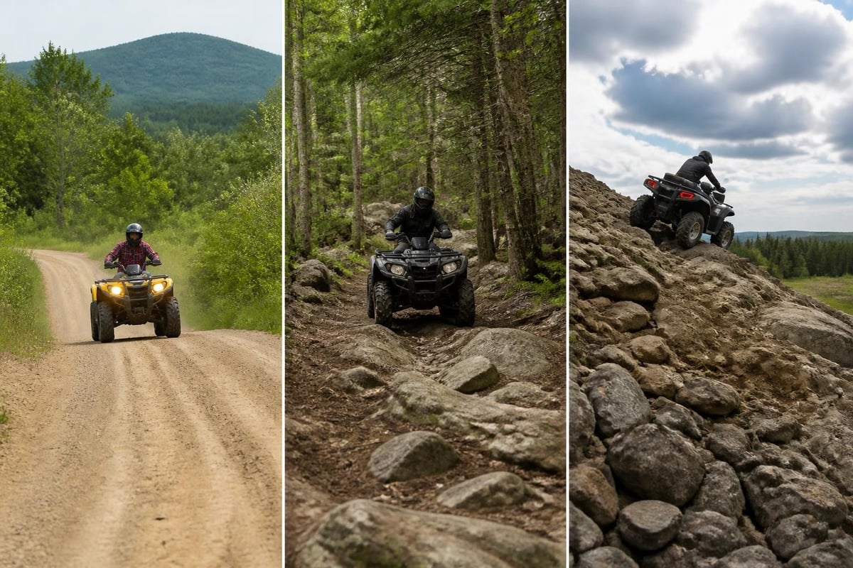
- Beginner routes: Wider, well-maintained trails with minimal elevation change, primarily in the immediate Jackman vicinity
- Intermediate trails: Moderate technical sections with some rocky areas, water crossings, and steeper grades
- Advanced routes: Challenging terrain including significant elevation changes, tight corners, and more remote backcountry sections
The Maine Department of Inland Fisheries & Wildlife provides official guidance on trail use policies that apply throughout the state, including right-of-way rules and environmental protection requirements.
Seasonal Considerations for Jackman Trail Riding
The riding season in Jackman typically extends from late May through October, though exact dates vary based on weather conditions and trail maintenance schedules.
Spring Opening Protocol
Trails generally open after mud season concludes and maintenance crews complete spring repairs. The Border Riders Sportsman’s Club trail status page provides real-time updates on seasonal openings, closures, and grooming activities specific to the Jackman network.
May through June conditions:
- Trails may remain soft in shaded areas
- Water crossings run higher from snowmelt
- Black flies are prevalent (bring insect protection)
- Wildflowers create spectacular scenery along open sections
Peak Riding Season
July through September offers optimal trail conditions with firm surfaces, moderate temperatures, and vibrant foliage. This period sees the highest visitor volume, particularly around holiday weekends.
Fall foliage season (late September through early October) attracts riders seeking spectacular autumn colors. The events calendar maintained by regional tourism organizations highlights organized rides and rallies scheduled during peak seasons.
Weather Preparedness
Northern Maine weather can change rapidly. Your jackman maine atv trail map should accompany a comprehensive preparation checklist:
- Check forecasts for the entire riding area before departure
- Pack layered clothing suitable for temperature swings of 30+ degrees
- Carry rain gear regardless of morning conditions
- Bring emergency supplies including first aid, fire starter, and emergency shelter
- Download offline maps as cell coverage is limited in backcountry areas
Trail Etiquette and Regulations
Responsible riding ensures trail access remains available for future generations. Maine law and local regulations govern ATV use throughout the Jackman area.
Registration and Legal Requirements
All ATVs operated on public trails in Maine must display current registration. Out-of-state visitors can purchase temporary registrations valid for consecutive days. Operators under 16 require safety certification and must be supervised by a licensed adult.
The Maine ATV Coalition provides comprehensive rider information covering legal requirements, safety standards, and trail-opening guidance applicable across the state.
Trail Courtesy Standards
Stay on marked trails: Cutting corners or creating new paths causes erosion and damages fragile ecosystems. Your jackman maine atv trail map indicates approved routes-respect these boundaries.
Yield appropriately: Slower vehicles should yield to faster traffic when safe. Uphill traffic has right-of-way on narrow sections. Always reduce speed when encountering horseback riders, hikers, or bicyclists.
Pack out all trash: The remote beauty of Jackman's backcountry depends on visitor stewardship. Carry bags for waste and dispose of materials properly in town.
Respect private property: Some trail sections cross private land through landowner agreements. Trespassing, littering, or reckless behavior jeopardizes these access arrangements for all riders.
| Regulation Category | Requirement | Penalty for Violation |
|---|---|---|
| Registration | Current Maine or reciprocal state registration | $100-$500 fine |
| Age restrictions | Under 16 must have safety certificate and supervision | $50-$200 fine |
| Speed limits | 20 mph residential areas, reasonable for conditions elsewhere | $100-$500 fine |
| Alcohol/drugs | Zero tolerance while operating | License suspension, criminal charges |
Planning Your Jackman ATV Adventure
Successful trips require advance preparation beyond simply obtaining a jackman maine atv trail map. Consider these planning elements for an optimal experience.
Lodging and Amenities
Jackman offers several ATV-friendly accommodations:
- Trailside lodges with direct trail access from the property
- Campgrounds accommodating RVs and trailers near trailheads
- Traditional hotels in downtown Jackman with secure parking for trailers
- Remote camps for multi-day backcountry expeditions
Book early during peak seasons, as the area's limited lodging capacity fills quickly, especially during foliage season and holiday weekends.
Fuel and Service Considerations
Gas stations in Jackman provide the last reliable fuel before heading into remote trail sections. Northern routes may require 40-50 miles between fuel opportunities. Calculate your ATV's range and plan refueling stops accordingly.
Limited mechanical services operate in Jackman for emergency repairs. Carry basic tools, spare belts, and essential fluids for trail-side fixes. The nearest major parts suppliers are located 50+ miles south, making self-sufficiency critical.
Connecting to Broader Trail Networks
One of Jackman's greatest advantages is connectivity to extensive regional systems. Your jackman maine atv trail map shows junction points linking to:
Southern connections: Routes toward The Forks, Moosehead Lake, and eventually the Kennebec Valley provide multi-day expedition opportunities through central Maine's wilderness.
Eastern routes: Trails extend toward Greenville and the eastern shore of Moosehead Lake, Maine's largest body of water.
Northern access: International riders can connect to Quebec's trail systems, though crossing requirements include proper documentation and awareness of customs regulations.
Western corridors: Trails reach toward the North Maine Woods and beyond to the Rangeley Lakes region.
Trail Maintenance and Club Support
The extensive network shown on any jackman maine atv trail map exists thanks to dedicated volunteer efforts and club organization. Understanding this infrastructure helps riders contribute to trail sustainability.
Border Riders Sportsman's Club
This local organization shoulders primary responsibility for maintaining Jackman-area trails. The club coordinates:
- Spring and fall trail clearing and maintenance
- Bridge construction and repair
- Trail marking and signage updates
- Grooming operations during riding season
- Communication with landowners who permit trail crossings
Membership fees and trail donations directly fund these activities. Consider joining or contributing if you frequently ride Jackman trails.
Volunteer Opportunities
Trail work days welcome riders willing to help maintain the network. Activities include clearing brush, repairing erosion damage, installing drainage systems, and refreshing trail markers. These events typically occur in spring before trail opening and fall after season closure.
Contact information for volunteer coordination appears on club websites and local bulletin boards throughout Jackman.
Safety Essentials for Backcountry Riding
The remote nature of trails shown on your jackman maine atv trail map demands thorough safety preparation. Cell phone coverage proves unreliable in much of the riding area, requiring self-rescue capabilities.
Essential Safety Equipment
Every rider should carry:
- First aid kit with supplies for treating cuts, sprains, and burns
- Communication device (satellite messenger or personal locator beacon for truly remote areas)
- GPS unit with downloaded trail data as backup to paper maps
- Tool kit appropriate for your specific ATV model
- Tow strap rated for your machine's weight
- Fire starter and emergency shelter for unexpected overnights
- Extra food and water beyond what you expect to need
- Headlamp with spare batteries for after-dark scenarios
Riding Group Best Practices
Never ride alone in remote backcountry. Groups should:
- Maintain visual contact between riders
- Establish meeting points for the day's route
- Designate a sweep rider to ensure no one gets left behind
- Share detailed itineraries with someone not on the trip
- Carry group first aid training and emergency response knowledge
Maximizing Your Trail Experience
Beyond simply navigating routes on your jackman maine atv trail map, enhancing your riding experience involves embracing everything the region offers.
Wildlife Viewing Opportunities
Jackman's trails traverse prime habitat for:
- Moose: Most active during dawn and dusk hours, especially near wetlands and streams
- White-tailed deer: Common throughout forested sections
- Black bear: Occasionally visible but typically avoid human presence
- Raptors: Eagles, hawks, and owls hunt along trail corridors
- Songbirds: Spring and summer bring spectacular variety
Carry binoculars and maintain respectful distances from all wildlife. Never approach, feed, or harass animals.
Photography and Scenic Stops
Several locations along Jackman trails offer exceptional photo opportunities:
- Overlooks providing views across forested valleys
- Water crossings where rivers and streams create dynamic compositions
- Historic logging sites showing remnants of the region's timber heritage
- Wetland areas with mirror-like reflections during calm conditions
Plan extra time in your riding schedule for scenic stops. Rushing through these incredible landscapes misses much of what makes Jackman special.
Connecting with the Broader Kennebec Valley Region
While focused on the Jackman area, riders using a jackman maine atv trail map can access broader recreational opportunities throughout western Maine. The southern trail connections lead toward The Forks and the upper Kennebec River valley, where whitewater rafting and other outdoor adventures complement ATV experiences.
Multi-day trips might combine trail riding with:
- River-based activities on the Kennebec or Dead Rivers
- Hiking in the Bigelow Preserve
- Fishing in remote ponds and streams
- Cultural experiences in historic valley communities
This integrated approach to outdoor recreation showcases the full range of what Maine's western mountains offer adventurous visitors.
Navigating Jackman's extensive trail network requires preparation, proper mapping resources, and respect for this remarkable wilderness environment. Whether you're planning a day ride from town or a multi-day backcountry expedition, having accurate trail information and understanding seasonal conditions sets the foundation for memorable experiences. The Kennebec Valley Tourism Council provides comprehensive resources for planning your visit to western Maine, including detailed information about trail access, seasonal activities, lodging options, and regional events that enhance your ATV adventure in Jackman and throughout the broader Kennebec Valley.